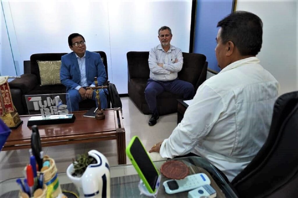
Agencia Peruana de Noticias PRENSAPERU.PE https://prensaperu.pe Twitter: @prensaperupe El alcalde de Tumbes Mg. Jimy Silva Mena se reunió con el titular de GeoPerú y territorios digitales confiables Arq. Donny Chumpitaz y el representante del Plan Binacional capítulo Perú–Ecuador Francisco Bolaños, en dicha reunión trataron temas sobre aplicativos del observatorio ciudadano digital, promocionar el turismo de manera internacional, además de coordinar proyectos del Plan Binacional con la Municipalidad Provincial de Tumbes, los Proyectos de Transformación Digital y el escalamiento a nivel plata de la ISO 18091.
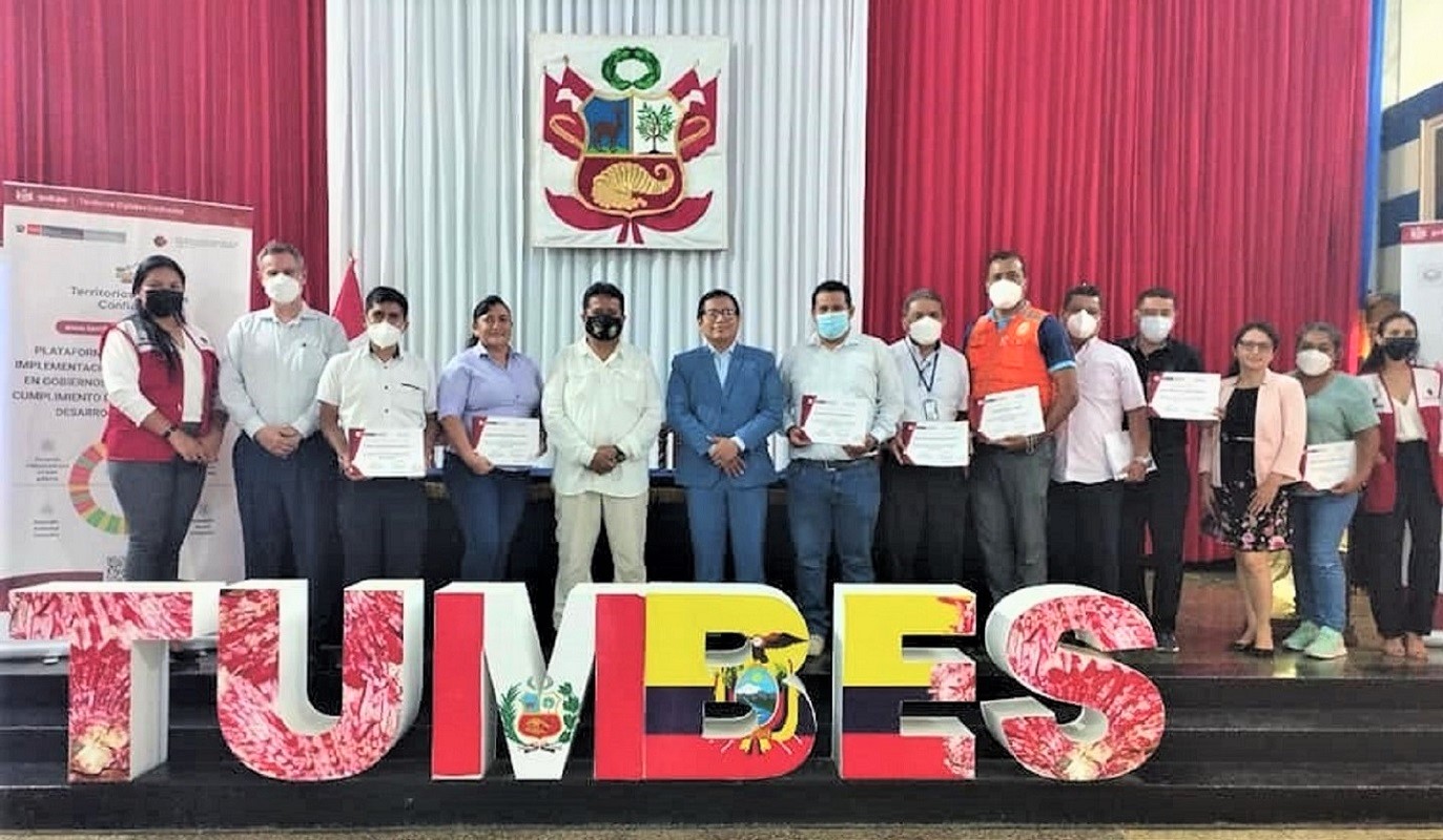
La cita fue la ocasión para que en una ceremonia se realice la entrega de certificados a diversos funcionarios municipales que fueron parte del proceso para la obtención del reconocimiento internacional de la norma ISO 18091:2019 en el marco de los territorios Digitales Confiables.
En diálogo con la Agencia Peruana de Noticias PrensaPerú.pe el alcalde de Tumbes Mg. Jimy Silva Mena, indicó: “Este logro de su administración edil, es muy importante para el desarrollo y crecimiento del territorio que lidera al frente de la municipalidad de su ciudad, y creemos que es necesario que se difunda este trabajo articulado entre el Estado y los gobiernos locales porque permiten mejorar la vida de nuestros ciudadanos y acelerar el cierre de las brechas que todavía existen en nuestro país”, puntualizó.
Como se recuerda en mayo de este año en el marco del eje 8 de la Política General de Gobierno que establece el compromiso de impulsar una transformación digital con equidad, la municipalidad de Tumbes se convirtió en uno primeros municipios provinciales del país en recibir el reconocimiento internacional ISO 18091:2019, de cuatro municipios que acreditaron tal reconocimiento, es así como Tumbes ostenta a la fecha la denominación de “Gestión Digital en el Gobierno Local”, por su profundo compromiso con el uso de datos, mapas digitales y tecnologías exponenciales en el territorio para el logro de los 17 Objetivos de Desarrollo Sostenible, de la “Agenda 2030”, de la ONU.
La acreditación internacional lograda por el gobierno municipal de Tumbes, ha significado todo un proceso de revisión y aprobación por parte del Consejo Mundial para la Calidad y de la Fundación Internacional para el Desarrollo de Gobiernos Confiables (FIDEGOC), de la información territorial digitalizada para el cumplimiento de 39 indicadores de políticas públicas organizados en función a los Objetivos de Desarrollo Sostenible (ODS) establecidos por la Organización de Naciones Unidas.
GEOPERÚ
GeoPerú es una plataforma digital que integra información interinstitucional en nueve categorías que permitirá facilitar la toma de decisiones a los alcaldes y las autoridades a escala nacional, adscrita a la Presidencia del Consejo de Ministros del Perú.
La plataforma GeoPerú tiene cientos de mapas provenientes de diversas entidades públicas y de organismos internacionales”, en donde se incluyen mapas cartográficos, así como referencias de infraestructura, pobreza monetaria, brechas digitales, programas sociales, conectividad, salud, educación, cultura, entre otros. Los datos se actualizan de acuerdo a cada fuente oficial.
Con estos recursos e instrumentos propios de un país moderno, se puede identificar brechas sociales, económicas y de infraestructura de cada región, las autoridades de todo el país pueden usar GeoPerú como herramienta de apoyo para la planificación territorial, dando seguimiento a la ejecución financiera de los proyectos a nivel regional, provincial y distrital en los diferentes niveles de Gobierno.
El Programa Territorios Digitales Confiables ofrece a los gobiernos regionales y locales la oportunidad de lograr la implementación de la norma internacional ISO 18091:2019, que les permita construir una visión compartida con los actores y agentes en todo el territorio nacional.
Fuente: Agencia Peruana de Noticias PRENSAPERU.PE https://prensaperu.pe Twitter: @prensaperupe
English translation
Mayor of Tumbes Jimy Silva and the holders of Geo Peru-Reliable Digital Territories and the Peru-Ecuador Chapter Binational Plan held a meeting.
Peruvian News Agency PRENSAPERU.PE https://prensaperu.pe Twitter: @prensaperupe The mayor of Tumbes Mg. Jimy Silva Mena met with the head of GeoPerú and reliable digital territories Arch. Donny Chumpitaz and the representative of the Peru-Ecuador Binational Plan, Francisco Bolaños,. of coordinating projects of the Binational Plan with the Provincial Municipality of Tumbes, the Digital Transformation Projects and the scaling to silver level of ISO 18091.
The appointment was the occasion for a ceremony to deliver certificates to various municipal officials who were part of the process to obtain international recognition of the ISO 18091: 2019 standard within the framework of Trusted Digital Territories.
In dialogue with the Peruvian News Agency PrensaPerú.pe, the mayor of Tumbes Mg. Jimy Silva Mena, indicated: “This achievement of your municipal administration is very important for the development and growth of the territory that you lead at the head of the municipality of your city, and we believe that it is necessary to spread this articulated work between the State and local governments because they allow us to improve the lives of our citizens and accelerate the closing of the gaps that still exist in our country”, he pointed out.
As recalled in May of this year within the framework of axis 8 of the General Government Policy that establishes the commitment to promote a digital transformation with equity, the municipality of Tumbes became one of the first provincial municipalities in the country to receive international recognition. ISO 18091:2019, from four municipalities that accredited such recognition, this is how Tumbes holds to date the name of “Digital Management in Local Government”, for its deep commitment to the use of data, digital maps and exponential technologies in the territory for the achievement of the 17 Sustainable Development Goals of the UN “2030 Agenda”.
The international accreditation achieved by the municipal government of Tumbes, has meant a whole review and approval process by the World Council for Quality and the International Foundation for the Development of Trustworthy Governments (FIDEGOC), of the digitized territorial information for the compliance with 39 public policy indicators organized according to the Sustainable Development Goals (SDG) established by the United Nations Organization.
GEOPERU
GeoPerú is a digital platform that integrates inter-institutional information in nine categories that will facilitate decision-making for mayors and authorities at the national level, attached to the Presidency of the Council of Ministers of Peru.
The GeoPerú platform has hundreds of maps from various public entities and international organizations”, which include cartographic maps, as well as references to infrastructure, monetary poverty, digital gaps, social programs, connectivity, health, education, culture, among others. . The data is updated according to each official source.
With these resources and instruments typical of a modern country, it is possible to identify social, economic and infrastructure gaps in each region, authorities throughout the country can use GeoPerú as a support tool for territorial planning, monitoring the financial execution of projects at the regional, provincial and district levels at the different levels of government.
The Trusted Digital Territories Program offers regional and local governments the opportunity to achieve the implementation of the ISO 18091:2019 international standard, which allows them to build a shared vision with the actors and agents throughout the national territory.
Source: Peruvian News Agency PRENSAPERU.PE https://prensaperu.pe Twitter: @prensaperupe